Tsirang District (Tsirang)
Tsirang District (Dzongkha: རྩི་རང་རྫོང་ཁག་; Wylie: Rtsi-rang rdzong-khag; previously (Chirang), is one of the 20 dzongkhags (districts) of Bhutan. The administrative center of the district is Damphu. Tsirang is noted for its gentle slopes and mild climates. The dzongkhag is also noted for its rich biodiversity; however, it is one of the few dzongkhags without a protected area. One of Bhutan's longest rivers, the Punatsang Chhu or Sankosh river flows through the district. It is the main district where the Lhotshampa resides. It has many beautiful places such as Rigsum Pemai Dumra, Pemachoeling Heritage Forest, Tsirang Namgyel Chholing Dratshang, and Nye.
The dominant language in Tsirang is Nepali, but it can be partially different from those spoken in Nepal, spoken by the heterogeneous Lhotshampa like Magar, Tamang, Gurung, Limbu, Rai, etc. In the north of Tsirang, Dzongkha, the national language, is also spoken.
The dominant language in Tsirang is Nepali, but it can be partially different from those spoken in Nepal, spoken by the heterogeneous Lhotshampa like Magar, Tamang, Gurung, Limbu, Rai, etc. In the north of Tsirang, Dzongkha, the national language, is also spoken.
Map - Tsirang District (Tsirang)
Map
Country - Bhutan
 |
 |
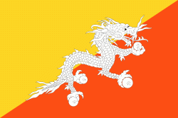
| Flag of Bhutan | |
The subalpine Himalayan mountains in the north rise from the country's lush subtropical plains in the south. In the Bhutanese Himalayas, there are peaks higher than 7000 m above sea level. Gangkhar Puensum is Bhutan's highest peak and is the highest unclimbed mountain in the world. The wildlife of Bhutan is notable for its diversity, including the Himalayan takin and golden langur. The capital and largest city is Thimphu, holding close to 1/7th of the population.
Currency / Language
| ISO | Currency | Symbol | Significant figures |
|---|---|---|---|
| BTN | Bhutanese ngultrum | Nu | 2 |
| INR | Indian rupee | ₹ | 2 |
| ISO | Language |
|---|---|
| DZ | Dzongkha language |


